Montenegro
Prokletije National Park
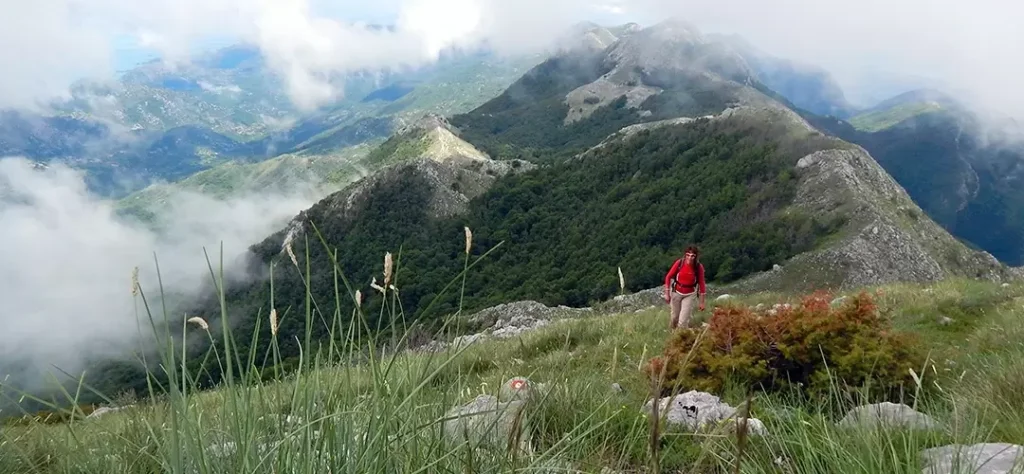
Prokletije are the youngest of Montenegro’s National Parks can be found in the southernmost part of the Dinaric Alps, along the Montenegro - Albania border. It features a striking massif and an abundance of sharp peaks and steep slopes over 2,000 m. Prokletije National Park also boasts glacial lakes, streams, rivers, springs, and an abundance of flora and fauna.
General Information
- Status: National Park since 2009.
- Location: Eastern Montenegro (Plav and Gusinje municipalities), extending from northern Albania to Kosovo.
- Area: 16,630 hectares.
- Elevation: Numerous peaks above 2,000m.
- Highest Peaks: Zla Kolata – 2534m (highest in Montenegro), Maja Jezercë at 2,694 m (highest in the national park).
- Climate: Continental, mountain, and sub-alpine with long, harsh winters and short, fresh summers.
Points of Interest
- Zla Kolata: The highest peak on the Montenegrin side of Prokletije.
- Alpine Lakes: Hridsko Ridsko Lake, Visitorsko, Ropojansko, Tatarijsko, Bjelajsko, Treskavac, Koljindarsko, and the pond at the Vizier’s beard, to name a few.
This is the least visited National Park in Montnegro since it is located in far North-East of the country. This is ideal place in Montenegro for people who are looking for active holiday and adventure in the mountains. It is suitable for those who are keen to spend their vocation on foot, rather than staying at the beach.